
Overnight lows dropped into the teens and 20s across southeastern Wisconsin. Some slick spots may develop from yesterday’s light snow and wet pavement.
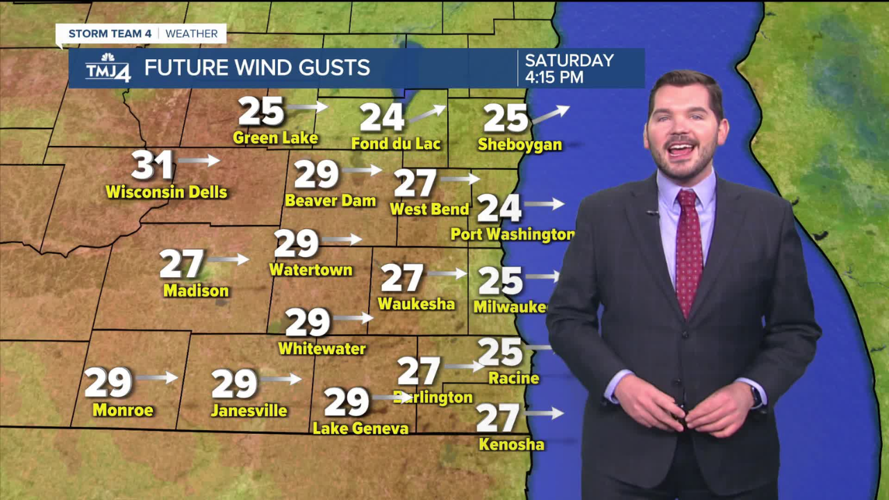
With the sun now out, temperatures are climbing into the 30s and should reach the mid to upper 40s later today. Breezy westerly winds will pick up, with gusts up to 25 mph.
Milder weather is on the way for tomorrow and early next week. Highs will reach the upper 50s tomorrow, with some inland areas possibly touching 60.
Most of southern Wisconsin will see highs around 60 on Monday. A cold front will bring cooler weather on Tuesday, with highs dipping into the lower 50s.
More clouds are expected midweek as temperatures settle in the 40s and 50s.
SATURDAY: Mostly sunny, high of 47°F. Wind from the southwest at 10-15 mph, with gusts up to 25 mph.
TONIGHT: Clear and cool, low of 30°F. Wind from the west at 5-15 mph.
SUNDAY: Mostly sunny and mild, high of 56°F.
MONDAY: Mostly sunny and mild, high of 60°F.
TUESDAY: Partly cloudy and cooler, high of 51°F.
WEDNESDAY: Mostly cloudy, high of 47°F.
Disclaimer- Our team has thoroughly fact-checked this article to ensure its accuracy and maintain its credibility. We are committed to providing honest and reliable content for our readers.