 by
by Eureka, CA – Residents of Northwest California are being urged to prepare for a wetter-than-normal weather pattern expected next week, as meteorologists warn of increased rainfall and potential travel disruptions. According to the National Weather Service (NWS) in Eureka, confidence is rising that a larger storm system will impact the region by mid- to late-week, bringing significant precipitation to both coastal and inland northern counties.
Forecasters say that while the overall trend is clear, the exact timing, intensity, and areas most affected remain uncertain. The NWS emphasizes that updates will continue throughout the week as new data becomes available and the system develops further offshore.
CPC Forecast Highlights Elevated Rainfall
The Climate Prediction Center (CPC) issued its 8–14 day outlook, highlighting the potential for above-average precipitation in Northwest California between October 23 and 29, 2025. The map shows coastal counties from Del Norte down to Marin, along with inland areas including Humboldt, Trinity, and Mendocino counties, in shades of green, indicating moderate to high chances of wetter-than-average conditions.
“While confidence is growing that a wetter pattern will take hold, residents should still monitor local forecasts for adjustments in timing and intensity,” said a spokesperson from the NWS Eureka office.
Meteorologists noted that early storms could bring measurable rain starting as soon as midweek, with heavier systems likely later in the week. This aligns with historical patterns for late October, when Northwest California typically experiences increased rainfall as Pacific storm systems move inland.
Impacts on Travel and Daily Life
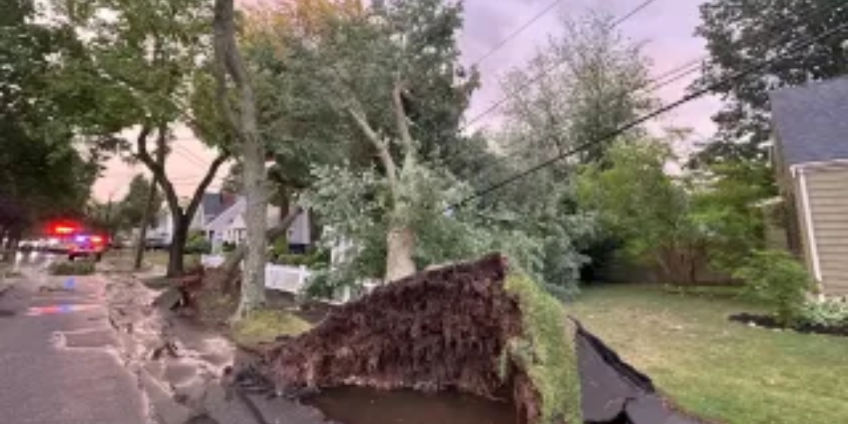
Officials are advising residents to remain cautious on the roads, particularly in rural and flood-prone areas. Wet conditions can lead to slick surfaces, limited visibility, and higher risks for accidents. Commuters and travelers are encouraged to allow extra time for their journeys and stay informed through local forecasts and traffic alerts.
“Even moderate rainfall can create hazardous driving conditions in the region’s winding coastal and mountainous roads,” said meteorologist Laura Bennett. “People should plan ahead and drive carefully.”
In addition to travel concerns, the wetter weather could impact outdoor events, construction projects, and recreational activities. Residents planning weekend hikes, camping trips, or other outdoor excursions are advised to check forecasts and consider rescheduling if heavy rain is predicted.
Read Also: Fort Wayne Weather Update: Fog Clears Early, Sunny Skies Dominate Before Weekend Showers
Benefits of Early Rain
While stormy conditions bring challenges, forecasters note that early rainfall could provide much-needed relief to dry areas. Some regions of Northern California have experienced below-average precipitation this fall, and additional rain may help replenish soil moisture, support agriculture, and reduce wildfire risks.
“This upcoming storm system, if it develops as expected, could be a welcome change for parched areas,” said meteorologist. “However, it’s a balance — too much rain too quickly can lead to localized flooding and landslides.”
Emergency management teams are preparing for potential localized flooding, particularly along rivers, creeks, and low-lying areas. Residents living in these zones are encouraged to review evacuation routes and keep an eye on local advisories.
Staying Prepared
Experts stress the importance of staying informed and prepared in the days leading up to the storm. Simple precautions, such as securing outdoor furniture, checking gutters and drainage systems, and keeping an emergency kit ready, can help minimize disruption and ensure safety during heavy rainfall events.
“The situation is evolving, and our top recommendation is to stay updated and cautious,” said the NWS spokesperson.
Residents can follow updates through local news, NWS forecasts, and social media channels for the latest information on the storm’s progress.
Northwest California residents should anticipate rain, plan ahead for travel, and exercise caution in flood-prone areas over the next week as the storm system approaches.
Stay prepared and informed — for more updates, visit race-day-live.com.