 by
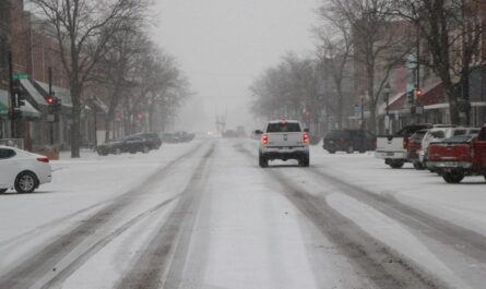
by SNOQUALMIE PASS, Wash. — The first major snowstorm of the season blanketed Washington’s Cascade Mountains over the weekend, slowing traffic but fueling excitement for ski resorts now eyeing an earlier-than-usual start to winter.
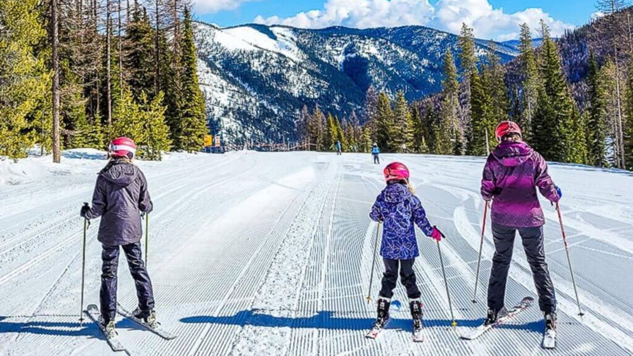
At The Summit at Snoqualmie, roughly 5 to 6 inches of wet, heavy snow covered the base — one of the earliest snowfalls in nearly a decade. While not quite enough to open the slopes, staff said it’s a promising start for what could be a strong, snow-filled season ahead.
Resorts Prepare for a Possible Early Opening
“This is a big change because, as you can tell, we’ve got a fair amount of snow on the ground,” said Carter Riach, spokesperson for the Summit at Snoqualmie. “Typically, these first snowfalls don’t happen until mid-November. We’re tracking a little ahead of normal this year.”
For ski areas across the Cascades, at least three feet of snowpack is required to safely open terrain. The Summit at Snoqualmie typically opens in early December, but officials say this early storm — coupled with La Niña weather conditions — could signal an early start to the 2025 ski season.
Investing in Snowmaking Technology
This winter, resort staff are taking no chances. The Summit is deploying its first fleet of snowmaking machines, designed to reinforce early-season snowpack and extend operations later into spring.
“We’re venturing into snowmaking to bolster our early-season base and make it possible to open earlier than usual,” Riach explained. He noted that the move is part of a long-term strategy to adapt to increasingly unpredictable weather patterns in the Pacific Northwest.
Storm Brings Snow — and Slick Roads
The weekend’s storm was powered by a strong atmospheric river, which dropped snow levels to around 3,000 feet. Nearby Stevens and White passes recorded close to a foot of snow, with heavier totals reported near Mount Rainier.
In Seattle, the same system brought over an inch of rain, marking the city’s first 1-inch day since December 2023.
For drivers, the quick shift in weather served as a reminder that winter driving season has begun. Traffic slowed considerably on Snoqualmie Pass, where slick roads and limited visibility made conditions challenging.
“Take your time,” said truck driver Bryce Johnson, who regularly drives through the area. “If you get nervous, pull over, regroup — there’s no rush up here.”
Crews on Alert Across Washington
The Washington State Department of Transportation (WSDOT) said nearly 1,500 maintenance workers are now on winter standby across the state — from Forks to Spokane — ready to “swarm to the storm” when severe weather hits.
Crews are inspecting plows, stockpiling salt and de-icer, and prioritizing key highway routes to keep the mountain passes clear and safe.
A Promising La Niña Forecast
Forecasters expect La Niña conditions to persist through winter, typically bringing cooler and wetter weather to the Pacific Northwest — a combination that could mean above-average snowfall for skiers and snowboarders.
“So we live in Queensland, and it’s unseasonably hot right now,” said Sam Nunn, an Australian visitor who stopped to photograph the snow. “Maybe that’s Mother Nature doing her balancing act — hot there, snowing here early.”
Read Also: South Jersey Weather Alert: Frost Advisory in Effect 2–9 AM Tuesday
Looking Ahead
Despite the early snow, resort staff said warmer temperatures later this week will likely melt much of the first snowfall before the next system arrives. Still, optimism is high.
The Summit West area traditionally opens first each year, often followed by Crystal Mountain and Stevens Pass. With snowmaking now in place and La Niña favoring a colder season, resort officials believe this winter could deliver one of the longest and most reliable ski seasons in recent years.
“We’re ready to welcome skiers as soon as conditions allow,” said Riach. “If this storm is any indication, we’re off to a great start.”
Are you planning to hit the slopes early this year? Share your thoughts and experiences with fellow winter sports fans at race-day-live.com.