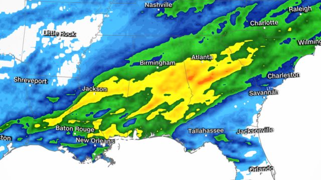
Heavy showers and thunderstorms are clearing to the north/northeast across Louisiana, Mississippi, and Alabama as energy from the Gulf of Mexico moves north ahead of a cold front.
Locally high gusts, tiny hail, frequent lightning, and heavy rain are likely across the forecast areas, with the possibility of a few funnel clouds. This is due to a powerful cold front pulling up tropical energy, which is followed by relatively cooler/colder air.
Expect sporadic heavy showers and thunderstorms to continue, with some of the action reaching Tennessee and Florida’s panhandle. As that front moves eastward, isolated showers and thunderstorms may affect areas of Georgia overnight and/or tomorrow.
Colder air will follow it, causing temperatures to plummet to near-freezing levels tonight in Oklahoma. With clear sky and light winds, radiational cooling will occur, raising the possibility of heavy frost tonight. Frost may damage late-season crops and plants.

