Residents of northeast Nebraska and northwest Iowa are bracing for another round of severe winter weather as heavy snow and dangerously low temperatures are set to impact the region this weekend and into next week. Forecasters warn of scattered snow developing after midnight on Saturday, which could bring freezing rain and sleet, particularly south of Interstate 80 (I-80). A heavier band of snow is expected to form near and just north of I-80, potentially covering the Omaha metro area and leading to hazardous travel conditions.
While lighter snow is expected in most areas, neighborhoods under the heavy snow band could see as much as six inches of snowfall. Areas west and south of Omaha are projected to receive a much lighter accumulation, with totals expected between 0-1 inch. Meanwhile, Omaha and areas to the northeast are more likely to experience 1-3 inches of snow by Saturday morning.
Weekend Snowfall and Travel Impacts
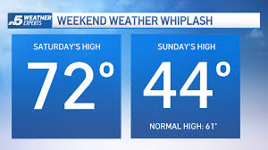
As the snow showers move southward on Saturday morning, residents can expect lingering freezing rain in some areas, especially south of Omaha. The day will remain mostly cloudy and windy, with temperatures starting in the mid-20s before dropping into the low 20s in the afternoon.
Snowfall will continue to create difficult driving conditions throughout Saturday, and motorists are advised to exercise caution. The Omaha metro area, in particular, will experience variable road conditions depending on the location of the heavier snow bands. The Nebraska Department of Transportation and emergency officials urge residents to check weather updates and road conditions before traveling.
Brutal Cold Follows Snowfall
Sunday will bring even colder temperatures, with highs barely reaching 10°F. Strong winds early in the day will make it feel even colder, though wind speeds are expected to decrease by the afternoon. The frigid conditions will persist into the next week, with nighttime lows dropping well below zero.
The coldest day of the week is expected to be Tuesday, with morning temperatures plunging to -10°F and struggling to rise above zero in the afternoon. Wind chills could make it feel like -20°F or lower, increasing the risk of frostbite and hypothermia for those exposed to the elements for extended periods.
Another Round of Snow Expected Early Next Week
On Monday morning, another round of snow will move into the region, bringing widespread snowfall throughout the day. While a brief break in precipitation is expected Monday night, additional snowfall is likely on Tuesday, with the heaviest accumulation occurring south of Omaha.
Forecasters predict that Omaha could receive a couple more inches of snow early next week, with lower totals expected further north. The combination of fresh snow and frigid temperatures will create hazardous conditions for travelers and residents alike.
Forecast Overview: Frigid Week Ahead
- Saturday: Mostly cloudy, scattered snow and freezing rain, windy. High: 21°F.
- Saturday Night: Partly cloudy, windy. Low: 1°F.
- Sunday: Partly cloudy, windy early, high of 10°F.
- Monday: Mostly cloudy with snow showers, high of 8°F.
- Tuesday: The coldest day of the week, starting at -10°F, with an afternoon high barely above zero.
- Wednesday: A slight improvement, with some sunshine but temperatures remaining in the single digits.
- Thursday: Another frigid start, but temperatures could finally rise into the double digits above zero.
Extreme Cold Safety Tips
With dangerously cold temperatures expected next week, residents should take necessary precautions to stay safe. Here are some essential cold-weather safety tips:
- Dress in Layers: Wear multiple layers of clothing, including a hat, gloves, and a scarf, to retain body heat.
- Limit Outdoor Exposure: If possible, avoid spending extended time outdoors, especially during the early morning and late-night hours.
- Protect Pets: Bring pets indoors or provide them with adequate shelter and warmth.
- Check on Vulnerable Individuals: Ensure that elderly family members, neighbors, and those without proper heating have access to warmth and shelter.
- Prepare Your Vehicle: Keep an emergency winter survival kit in your car, including blankets, food, water, and a flashlight.
- Monitor Carbon Monoxide Levels: Never use ovens or outdoor grills as indoor heating sources, and ensure that carbon monoxide detectors are functioning properly.
Looking Ahead: When Will the Cold Snap End?
While the upcoming week will bring some of the coldest air of the season, there is some relief in sight. By next weekend, temperatures are expected to rise closer to average, with the possibility of above-normal temperatures returning. While it’s too early to say for certain, a warming trend could bring a much-needed break from the bitter cold.
Until then, residents of Nebraska and Iowa should brace for a week of frigid temperatures, dangerous wind chills, and ongoing snow. Staying informed and prepared will be key to navigating the challenging winter conditions in the days ahead.
Disclaimer – Our editorial team has thoroughly fact-checked this article to ensure its accuracy and eliminate any potential misinformation. We are dedicated to upholding the highest standards of integrity in our content.

