 by
by CINCINNATI, Ohio – Autumn in the Ohio Valley is turning out to be wetter than usual this year. After several days of steady rainfall, much of southern and central Ohio is now running above average for monthly precipitation, according to the National Weather Service (NWS) Ohio River Forecast Center. While the brief lull in showers over the weekend may offer some relief, another storm system is already set to return early next week, keeping conditions soggy through Tuesday.
Rainfall Surplus Across the Region
The NWS reports that the Ohio River corridor — from Louisville to Cincinnati and up toward Cleveland — has recorded 120% to 150% of typical rainfall totals for this time of year. The surplus comes from a succession of low-pressure systems that have brought widespread rain and occasional thunderstorms since mid-September.
Farther west, parts of Indiana and southern Illinois remain comparatively dry, with precipitation deficits still lingering from late summer. However, the persistent moisture in the Ohio Valley has kept soils saturated and streams running high, especially near the Scioto, Great Miami, and Muskingum River basins.
Forecasters expect another 1 to 2 inches of rainfall to develop between Monday and Tuesday, primarily across southern and eastern Ohio, northern West Virginia, and western Pennsylvania.
Impacts on Roads and Travel
Transportation officials are urging drivers to remain cautious, particularly during heavier rainfall periods. The Ohio Department of Transportation (ODOT) has warned of ponding and hydroplaning risks along major highways such as I-70, I-71, and I-75, where drainage systems are already strained from recent storms.
“Even a half-inch of rain on already wet pavement can lead to dangerous conditions,” ODOT noted. Reduced visibility and slick roadways are expected to be most pronounced during the early morning and evening commute hours.
Motorists are advised to slow down in rain, maintain extra following distance, and never attempt to drive through flooded roadways, even if the water looks shallow.
Rivers, Streams, and Local Flood Risks
Although river levels remain within normal banks, forecasters caution that smaller creeks and low-lying areas could experience brief flooding during the heaviest downpours.
The Ohio River itself is projected to fluctuate but stay well below flood stage in cities such as Cincinnati, Portsmouth, and Wheeling. Local emergency management agencies recommend residents clear storm drains and gutters to prevent urban flooding, especially in older neighborhoods with limited drainage systems.
Cooler Temperatures, But Mild Overall
Despite the wetter pattern, temperatures are expected to stay near seasonal averages. Highs will range from the mid-60s to low 70s through the weekend, while nighttime lows dip into the upper 40s and low 50s.
Sunday should offer a brief window of drier, partly sunny conditions, though forecasters say clouds will quickly return as the next weather system pushes in late Sunday night. Gusty winds could also develop by Monday afternoon, potentially causing isolated power interruptions if branches fall on utility lines.
Outlook for the Rest of October
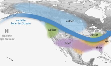
Meteorologists say the recent trend of wet, unsettled weather is consistent with El Niño-influenced patterns expected this fall. Warm air over the Gulf of Mexico and active jet stream dynamics are helping to funnel moisture into the Ohio Valley every few days.
“We’re seeing a strong signal for above-normal precipitation extending through mid-October,” said an NWS forecaster based in Wilmington, Ohio. “That doesn’t necessarily mean every day will be wet — but when it rains, it’s likely to come in steady batches.”
Looking ahead, the 8–14-day outlook from the Climate Prediction Center continues to favor above-average rainfall and slightly warmer-than-normal temperatures across the region. That could delay fall harvest operations and impact outdoor events like football games and fall festivals if the wet pattern persists.
Staying Prepared
Local officials encourage residents to keep storm kits, flashlights, and charged electronics handy in case of isolated outages during windy, wet conditions. Those planning weekend travel or outdoor gatherings should monitor updated forecasts from the NWS and ODOT to avoid last-minute weather disruptions.
Will the Ohio Valley stay stuck in this rainy pattern for the rest of October — or will drier weather finally return? Share your thoughts and local weather updates in the comments at race-day-live.com.