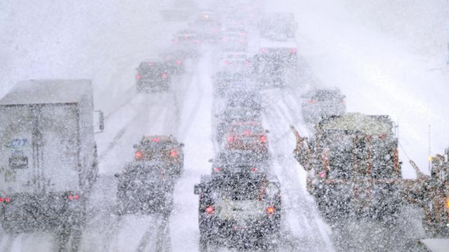
Some parts of the U.S. are going to be hit by a strong winter storm that will bring snow, cold temperatures, strong winds, and rain, just as millions of people across the country get ready to leave early for Thanksgiving.
The first big winter storm of the season is coming this week. It is the second of two storms that will hit the U.S. this week.
On Monday, the first storm system caused severe weather across the southern Plains and lower Mississippi Valley. In parts of Texas, Oklahoma, and Louisiana, there were several Severe Thunderstorm Warnings and Tornado Warnings.
The Denton County Office of Emergency Management in Texas says that strong winds in the city of Denton caused at least two tractor-trailers to flip over on Interstate 35. One of them landed on top of a pickup truck.
Emergency officials said that the southbound lanes of the interstate were closed while the event was looked into by first responders.
A video taken in Weatherford, Oklahoma, early Monday morning showed that the area was hit by bad weather with strong winds and heavy rain.
The Somervell County, Texas, Fire Department also shared a picture of a trailer that had been flipped over on its side by strong winds in the area.
This week, the storm system will move to the north, where it will meet up with cold air. This will cause snow to fall across the Dakotas and maybe even into parts of Minnesota and Wisconsin.
On Tuesday, strong winds are likely to form on the western side of the system. In the Dakotas, wind gusts could hit 50 to 60 mph.
As the rain turns to snow, the FOX Forecast Center said it could be dangerous to drive on Interstate 29 from Fargo, North Dakota, to Sioux Falls, South Dakota, and on Interstate 94 from Fargo to Bismarck, North Dakota.
Some places, like Minneapolis, Green Bay, and Milwaukee in Wisconsin, will be on high alert for snow showers on Wednesday. This is because colder air will be surrounding the storm system all day.
Especially since many people are planning to travel before Thanksgiving, the FOX Forecast Center says the second storm could have a bigger effect on more places.
In the Ohio River Valley and Great Lakes area, a strong low-pressure system is likely to form and grow very quickly. Later this week, this new low will get a lot stronger as it moves over the Great Lakes. This will increase the risk of high winds in the area and into the eastern U.S.
At the end of the week, the storm will move into the mid-Atlantic and Northeast. As it moves, winds will bring in enough cold air to support a big band of snow somewhere in the Ohio River Valley.
The southern part of the storm will have the coldest air, which will blow into the Appalachians.
The FOX Forecast Center says that’s where snow could fall in parts of the Ohio Valley, the northern mid-Atlantic, and the inland Northeast from the end of the week to the weekend. But weather forecasters said there is still a lot of mystery about how much cold air is available for snow.
As of right now, the National Weather Service has put out Winter Storm Watches for the mountains in eastern West Virginia and the Panhandle in western Maryland from Thursday afternoon to Saturday evening.
The FOX Forecast Center says there is also a chance of lake-effect snow, but it will depend on how the low-pressure system moves. The air may be too warm right now for lake-effect snow to form.
Make sure you get the free FOX Weather app and turn on notifications so you know when the weather changes.
In bad weather across the Northeast at the end of the week and into the weekend, air and car travel could be slowed down just as the Thanksgiving travel week starts.
Heavy rain could fall in the Northeast at times, but the FOX Forecast Center doesn’t think there will be flash flooding in the area right now because it has been so dry lately.
It does, however, bring much-needed rain to the area, which will help fight the ongoing risk of wildfires.
West of the country, this week a strong bomb cyclone connected to a big atmospheric river is expected to soak the area from California to Washington. This could cause flooding.
When talking about weather, the word “bomb cyclone” comes from the words “bombogenesis” or “explosive cyclogenesis.” This takes place when the center pressure of a storm system drops by at least 24 millibars in 24 hours.
FOX Forecast Center says a big stream of rain will hit on Tuesday night and will likely stay through the end of the week and maybe even into the weekend.
Source: Snow, rain to slam US as winter storms ramp up ahead of early Thanksgiving travel

