


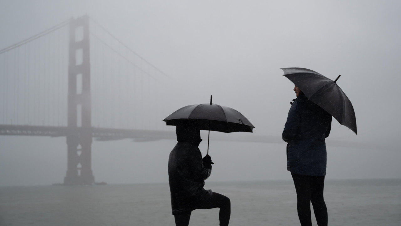
Race Day Live California is enjoying a brief break from the rain, but another storm is on the way. This weekend will bring calm and sunny weather, but by the middle of next week, a new storm system is expected to bring heavy rain and snow across the state.
While the Bay Area will see significant rainfall, Southern California may experience even heavier precipitation.
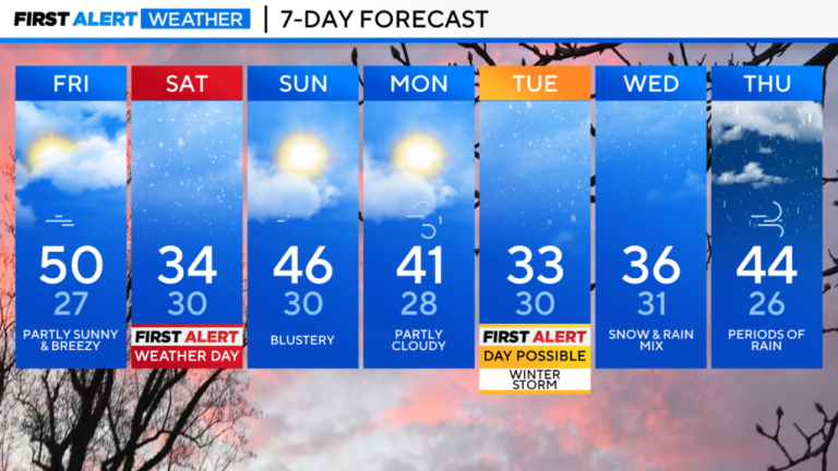
Starting Friday, high pressure will bring stable weather over California, leading to sunny days and cold mornings.
Daytime temperatures in the Bay Area will stay in the 50s, while interior areas could see temperatures drop into the 20s and 30s at night.
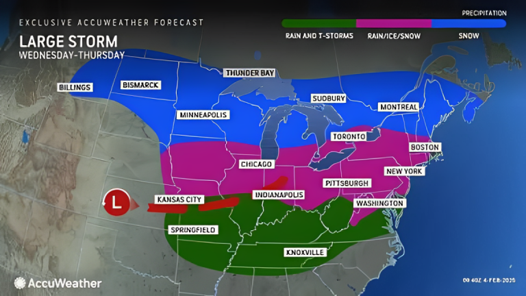
By Wednesday, a storm will develop over the Pacific and move toward California. Forecast models suggest widespread rain and snowfall, but the exact intensity remains uncertain.
Unlike previous storms, this system will also impact Southern California, where some areas could receive up to 3 inches of rain. This could lead to dangerous conditions, especially in burn scar regions.
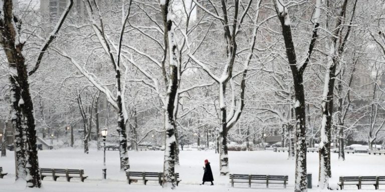
The incoming storm will also bring much colder air. Snowfall is expected at much lower elevations, possibly as low as 2,000 to 3,000 feet, meaning areas like Sonoma and Napa counties could see snowfall. The Sierra Nevada could receive several feet of snow.
Although the storm’s exact path is still uncertain, it is expected to tap into Pacific moisture and spread rain and snow across much of California.
Read More:
- Midwest Braces for Dangerous Ice Storm on February 5th, Disrupting Travel and Power!
- Montana Drivers: These Common Car Mistakes Could Cost You This Winter!
Here’s what to expect in different areas this weekend:
- San Francisco: Friday will start with clouds and scattered showers, followed by sunshine in the afternoon. Highs will reach the mid-50s, with morning temperatures dropping into the upper 30s. The weekend will be sunny with similar temperatures.
- North Bay: Scattered showers on Friday morning will clear by the afternoon. Expect chilly mornings with temperatures in the upper 20s to mid-30s and sunny afternoons with highs in the mid-to-upper 50s.
- East Bay: A few rain showers may appear on Friday morning, but skies will clear later. The weekend will be sunny but cold, with lows in the upper 20s to low 30s and highs in the mid-50s.
- Pacific Coast & Peninsula: Brief heavy rain showers may hit the coast on Friday morning before skies clear in the afternoon. The weekend will be sunny, with morning temperatures in the upper 30s to low 40s and highs in the mid-50s.
- Santa Cruz & South Bay: Scattered showers in the Santa Cruz Mountains may continue Friday morning. The Santa Clara Valley is expected to stay dry. By the afternoon, skies will be sunny, with highs in the upper 50s to low 60s. Weekend mornings will be cold, dropping into the low 30s, with sunshine during the day.
Although the weekend will be pleasant, the next storm is expected to arrive midweek, bringing widespread rain, snow, and colder temperatures across California.
Stay updated on the forecast and prepare for potential impacts.
Disclaimer- Our team has thoroughly fact-checked this article to ensure its accuracy and maintain its credibility. We are committed to providing honest and reliable content for our readers.


+ There are no comments
Add yours