


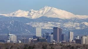
This weekend, Colorado is gearing up for a big weather shift, as a major snowstorm is expected to blanket the mountains of Colorado, bringing significant snow accumulation in certain areas. Some places may see anywhere from 1 to 3 feet of snow by Saturday night, with warnings in place for dangerous winter conditions in the western mountains of the state. However, for the Denver metro area, things will be much milder, offering a warmer and less snowy Valentine’s Day, before temperatures drop again over the weekend.
A Major Snowstorm Hits the Colorado Mountains
The snowstorm making its way through Colorado this weekend will bring winter weather warnings and advisories across much of the state. According to the National Weather Service, a Winter Storm Warning has been issued for the western mountains, which includes popular areas like Aspen, Vail, and Telluride. These areas are expected to receive heavy snow, with some mountain regions accumulating up to 3 feet of snow by the time the storm moves out late Saturday night. Skiers and winter enthusiasts are advised to prepare for extremely difficult travel conditions in these areas.
In addition to the Winter Storm Warning, there is also a Winter Weather Advisory for other mountainous areas, including the northern Front Range and the Sangre De Cristo mountains. These areas can expect a lighter but still significant snow accumulation, with up to 6 to 12 inches of snow likely in higher elevations. This could make for treacherous travel conditions on roads, especially at higher altitudes.
The Colorado Department of Transportation (CDOT) has already issued travel warnings, encouraging those planning to travel through the mountains over the next two days to be aware of the snowy conditions. The I-70 corridor, which leads to many of Colorado’s ski resorts, is expected to be especially busy as visitors flock to the mountains to hit the slopes. If you’re planning on heading to the mountains this weekend, CDOT recommends checking road conditions before hitting the road, as travel could be slow or even halted in some cases due to snow accumulation.
The snowstorm is expected to begin impacting the state Thursday night, with heavier snow moving in by Friday morning and continuing into Saturday evening. Blizzard-like conditions could make it very difficult to navigate through the mountainous areas, especially along mountain passes.
What’s in Store for Denver This Valentine’s Day
While the mountains will experience a snowstorm, the Denver metro area will see much milder conditions for Valentine’s Day. Expect to see warmer temperatures compared to the snow-covered peaks, with high temperatures in the low 40s and plenty of cloud cover throughout the day. There may be a few light rain showers popping up throughout the afternoon and evening, but no significant snow is expected in the city for now.
For those in the Denver metro area planning to celebrate Valentine’s Day with an outdoor activity, it will be a relatively comfortable day. However, make sure to dress in layers, as the temperature will still feel cool, particularly in the morning and evening hours. The chance of rain will also increase later in the day, so having an umbrella or rain jacket handy could be helpful if you plan to go out for a walk or dinner.
Though the Denver metro area won’t see heavy snow, cloud cover and the occasional rain showers may make for a gray, overcast day. While it might not be perfect weather for an outdoor date, it could still be a cozy day to stay inside with a loved one and enjoy some indoor activities.
Weather Changes Continue Over the Weekend
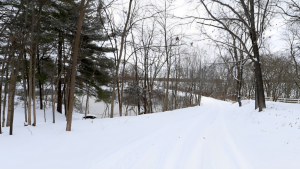
Saturday will bring colder temperatures to the Denver metro area, marking a shift in the weather as the snowstorm moves through. The high temperature will likely drop to the low 30s, with the possibility of light snow in the area. Forecasters predict that 1/2 inch to just under 2 inches of snow could fall over the course of the day, although the snow accumulation will be relatively light compared to the mountains.
This snowfall may cause some disruptions, especially for drivers on the roads. While it is unlikely to be a significant snowstorm, it’s important to stay aware of road conditions as snow may make travel slick. The weather could also impact evening plans, so it’s wise to keep an eye on updates from local weather stations to stay ahead of any changes.
Impact of the Storm on Colorado’s Ski Resorts
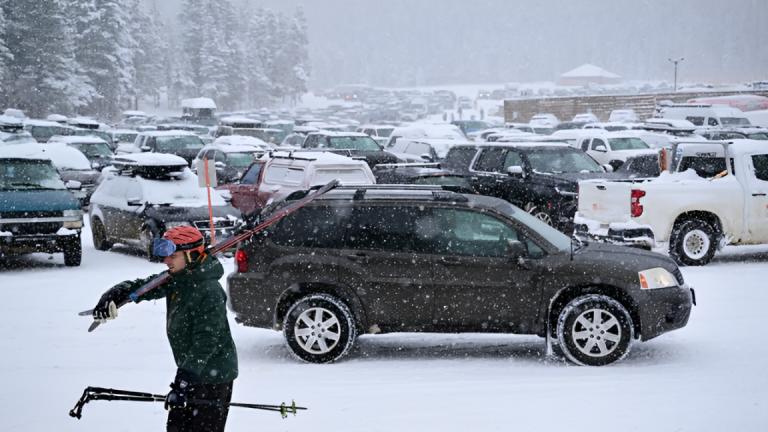
The upcoming snowstorm will likely have a major impact on Colorado’s ski resorts. Skiers and snowboarders will be excited about the fresh snow, with resorts like Vail, Breckenridge, and Aspen likely to see excellent conditions for the weekend. However, for those planning to hit the slopes, it’s essential to be prepared for possible snowy, windy conditions that could make it harder to navigate certain mountain areas. The visibility at higher altitudes could be limited, and snow accumulation might lead to closures or delays in ski lifts.
As mentioned earlier, CDOT has advised travelers to expect heavy traffic on highways leading to ski resorts, especially the I-70 corridor. Since many Coloradans and tourists visit the ski resorts over the weekend, roads could become crowded, making for a longer trip. Chain law restrictions could also be enforced on mountain highways, so be sure to carry chains or snow tires if you plan to travel through the mountains.
If you’re planning to ski or snowboard in the mountains this weekend, be sure to check weather updates, follow safety instructions from ski resorts, and stay informed about road conditions before you leave.
How to Stay Safe in Winter Weather
When winter storms hit, safety should always be a top priority. Whether you’re traveling in the mountains or staying in the city, here are a few tips to keep in mind:
- Check weather updates frequently: Always stay informed about changing conditions, especially if you plan to travel to the mountains. Use reliable weather apps and websites to monitor forecasts.
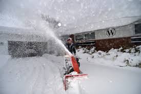
- Prepare for slippery roads: If you’re driving, make sure your car is equipped for winter weather. Carry emergency supplies like blankets, food, and water in case you get stranded.
- Drive cautiously: If you’re heading into the mountains, be mindful of snow and icy roads. Speed limits may need to be adjusted for slippery conditions, and keep extra distance between your vehicle and others.
- Dress warmly: For outdoor activities, dress in layers and wear waterproof clothing to stay dry. Don’t forget gloves, a hat, and boots to protect yourself from the cold.
- Be mindful of ski safety: If you’re going to a ski resort, be aware of the snow conditions and any warnings issued by the resort. Avoid skiing or snowboarding in areas with low visibility or heavy snow accumulation.
Conclusion
Colorado is preparing for a major winter storm that will bring significant snow to the mountains while offering a milder and cloudier day for the Denver metro area on Valentine’s Day. The weather conditions will create challenges for travelers, particularly in the mountain regions where heavy snow and difficult driving conditions are expected. Skiers are looking forward to fresh powder in the resorts, but it’s important to stay informed about road conditions and weather warnings.
For those in Denver, Valentine’s Day will be a bit warmer, with occasional rain showers, making it a comfortable day to stay inside or enjoy the milder outdoor conditions. As the storm continues into the weekend, expect colder temperatures and light snow in the metro area, but the biggest impact will be felt in the mountains. Stay safe and prepared, and keep an eye on weather updates throughout the weekend.
Disclaimer – Our editorial team has thoroughly fact-checked this article to ensure its accuracy and eliminate any potential misinformation. We are dedicated to upholding the highest standards of integrity in our content.


+ There are no comments
Add yours