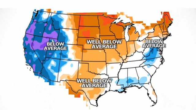
A low-pressure system approaching the West Coast today will deliver rare early-season snow and rain to California until Monday.
“A winter weather advisory is in effect for portions of the Sierra Nevada above 8,000 feet, where up to 4 inches of snow could fall tonight and Monday,” the National Weather Service office in Hanford stated.
Visitors to Yosemite National Area may see snow when driving through the area. Tuolumne Meadows and Tioga Pass, one of the park’s key thoroughfares, might see up to two inches of snow.
The last equivalent weather alert issued in September was a snow advisory from Yosemite to Kings Canyon in 2007.
There have only been five September snowfalls recorded at Grant Grove, California, which is located just west of Kings Canyon National Park and has an elevation of around 7,000 feet. The last time this location experienced snow in September was in 1986.
This system will move across the Intermountain West and into the Rockies on Tuesday. Up to one inch of rain is anticipated in parts of Idaho, Oregon, Nevada, and northern California, with isolated amounts of 2 to 4 inches likely through Thursday.
While these numbers may not appear to be significant, this is the driest time of year, therefore it will be equivalent to a month’s worth of rain for towns such as Reno, Boise, and Redding, California.
The widespread precipitation will also bring substantially colder temperatures to the region in the coming days. Temperatures in parts of Oregon, California, Nevada, and Idaho will be 15 to 20 degrees lower than typical, including Reno, Nevada; Medford, Oregon; Bakersfield, Fresno, and Sacramento, California.


+ There are no comments
Add yours