


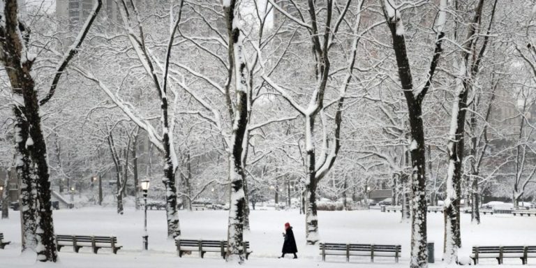
Race Day Live BALTIMORE – A winter storm is set to hit Maryland this weekend, bringing a mix of snow, sleet, and freezing rain.
Forecasters say the storm will arrive Saturday morning and last through Tuesday, making for hazardous travel conditions.
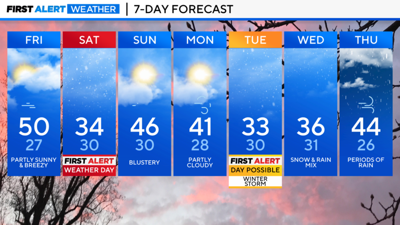
Tonight’s Forecast
Skies will be partly cloudy tonight, with temperatures dropping to the upper 20s and low 30s. Expect a chilly night before the storm moves in on Saturday.
Saturday: First Alert Weather Day
Clouds will increase in the morning, and temperatures will hover in the low to mid-30s. By late morning, precipitation will spread across the region, starting as snow before transitioning to sleet and freezing rain.
Ice accumulation is likely, creating slick roads and hazardous driving conditions. Areas north and west of Baltimore will see the most ice buildup.
The Baltimore metro area may receive about one-tenth of an inch of ice, while Western Maryland could see over a quarter-inch.
Saturday Night: Freezing Conditions Persist
Temperatures will stay near freezing, with icy conditions continuing into the night. While temperatures may rise slightly in Southern Maryland and the Eastern Shore, areas near the Pennsylvania border will likely remain below freezing.
Sunday: A Short Break
Sunday will bring a mix of clouds and sunshine, with temperatures reaching the mid-40s. Winds will pick up, making it feel colder, but no precipitation is expected.
Monday: Dry but Cold
Monday will remain dry, but temperatures will stay chilly, with highs around 40 degrees. Clouds will return, signaling the approach of another storm system.
Tuesday: Another Winter Storm Likely
Another round of wintry weather is expected Tuesday, with heavy snow and ice possible. North and west of I-95, heavier snowfall is likely, while areas south of I-95 may see a wintry mix.
Southern Maryland and the Lower Eastern Shore could start with snow before transitioning to rain in the afternoon.
It is still too early to predict snowfall totals, but significant accumulations could lead to school and work disruptions on Tuesday and Wednesday.
Read More:
- Storm Alert! Heavy Rain & Snow to Hit California Next Week!
- Winter Storm II: NYC and Tri-State Brace for Another Round of Snow
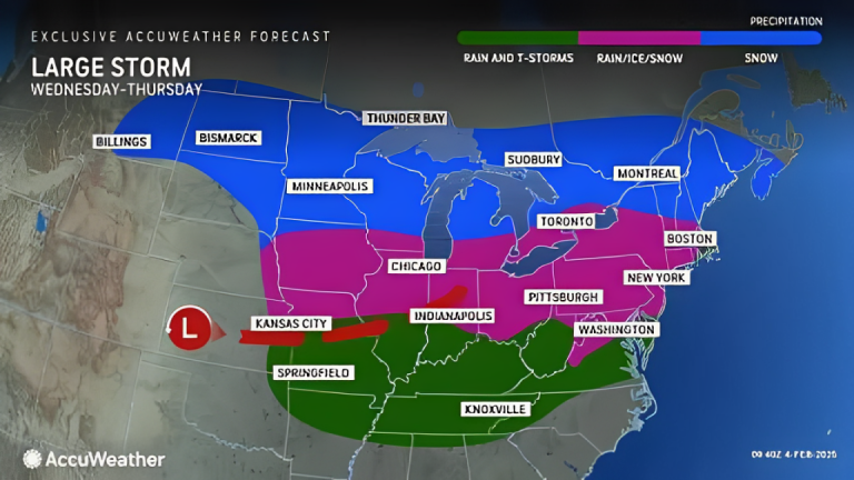
Wednesday: Lingering Snow Showers
Snow showers may continue Wednesday morning, but the storm system will move out quickly.
Thursday: Warmer Temperatures, Mostly Rain
A new system will arrive Thursday, bringing mainly rain due to warmer air. A brief wintry mix is possible at the onset, but rain will be the dominant form of precipitation.
High temperatures for the next few days:
- Tuesday: Low 30s
- Wednesday: Mid-to-upper 30s
- Thursday: Mid-40s
Friday and the Weekend: More Storms Possible
Colder air will return Friday, dropping temperatures to the mid-30s. Saturday will start dry, but another storm system could bring rain by Saturday night.
Stay updated with the latest forecasts as winter weather continues to impact Maryland.
Disclaimer- Our team has thoroughly fact-checked this article to ensure its accuracy and maintain its credibility. We are committed to providing honest and reliable content for our readers.


+ There are no comments
Add yours