


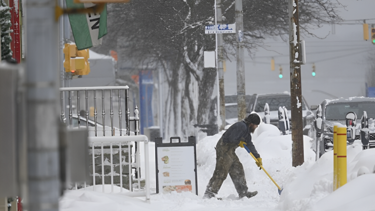
A significant winter storm is hitting Utah, bringing snow and hazardous conditions throughout the state. A winter weather alert has been issued as heavy snow continues to fall in various regions, particularly along the Wasatch Front and the surrounding mountain areas. The National Weather Service (NWS) has forecasted up to 15 inches of snow in certain locations, with the storm expected to last until 11 p.m. on Thursday.
Snowfall Accumulation and Affected Areas
The winter storm is expected to bring substantial snowfall, with accumulations reaching up to 15 inches in higher elevation areas, particularly the northern Wasatch Range and the Wasatch Mountains. Areas such as Salt Lake City and the northern part of Utah County will experience significant snow, though the accumulation in the valleys may be less, generally between 3 to 6 inches. Roads are expected to be slippery, and the NWS is urging residents to exercise caution while traveling, especially in the mountain areas, where conditions can quickly deteriorate.
The snow will continue to accumulate throughout Thursday, and by evening, conditions will improve as the storm moves out of the region. However, the impact of the snowstorm is expected to last through Thursday night, with icy conditions remaining on roads through the morning commute on Friday.
Impact on Travel and Commuters
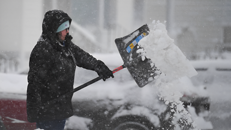
The storm is expected to cause major disruptions for commuters, particularly during the evening rush hour. Snow-covered and slick roads could lead to hazardous driving conditions, and there is the potential for accidents and delays on highways, especially along major corridors like I-15 and I-80.
Drivers are advised to slow down, increase following distances, and ensure that their vehicles are properly equipped with snow tires or chains where required. For those traveling in mountain areas, it is crucial to check road conditions before heading out, as snowplows will be working to clear the roads, but it may take time for all highways to be fully cleared of snow.
The Utah Department of Transportation (UDOT) has advised that snowplows and maintenance crews are actively working to keep major roads clear, but rural and less-traveled roads could experience prolonged snow coverage. The possibility of traffic accidents and travel delays is high, especially in higher elevations where snow accumulation is more intense.
Weather Conditions in Different Regions of Utah
While much of Utah will experience snowfall, some areas in the southern part of the state, such as St. George and the southern Utah deserts, will remain unaffected by the storm. These regions are expected to see mild temperatures and clear skies. However, the storm’s impact will be most pronounced in central and northern Utah, including the Salt Lake Valley, Utah County, and the Wasatch Mountains.
The heaviest snowfall is expected in the northern Wasatch and Utah mountain ranges, where visibility will be reduced due to snow, making travel more difficult and potentially dangerous. Drivers are encouraged to monitor weather updates and adjust their travel plans accordingly. The NWS is warning that conditions may change quickly, and those in affected areas should be prepared for sudden changes in weather.
Snow and Cold Temperatures Persist
While the storm will move out by Thursday night, residents should prepare for cold temperatures to persist throughout the week. Highs will remain in the 20s and 30s in many parts of the state, and lows will drop into the teens, especially in mountain and higher-elevation areas. Those planning to be outside for any extended period should dress warmly and take precautions to prevent hypothermia or frostbite, especially during the early morning hours when temperatures will be at their coldest.
Conclusion: Stay Prepared and Stay Safe
The winter storm in Utah is a reminder of the state’s unpredictable weather conditions during the winter months. Residents should be prepared for snow and icy conditions through Thursday evening, with travel disruptions expected throughout the day. The NWS continues to monitor the storm, and updates will be provided as conditions evolve. For now, drivers are encouraged to exercise caution, allow extra time for travel, and be aware of the potential for slippery roads. Residents in snow-prone areas should also be prepared for power outages or additional disruptions as the storm moves through.
Disclaimer – Our editorial team has thoroughly fact-checked this article to ensure its accuracy and eliminate any potential misinformation. We are dedicated to upholding the highest standards of integrity in our content.


+ There are no comments
Add yours